Provided Services
![]() Environments Sanitized with OZONE
Environments Sanitized with OZONE
![]() Free Internet Wi-Fi
Free Internet Wi-Fi
![]() Heated swimming pool
Heated swimming pool
![]() Lawn chairs
Lawn chairs
![]() Children’s playground
Children’s playground
![]() Covered parking
Covered parking
![]() Covered storage for bicycles, motorcycles and sports equipment
Covered storage for bicycles, motorcycles and sports equipment
![]() Gym
Gym
![]() Satellite TV
Satellite TV
![]() Dishes & Utensils
Dishes & Utensils
![]() Laundry
Laundry
![]() Barbecue
Barbecue
Car and Scooter Rental in Malcesine
Directly in front of Casa Guarnati Holiday Apartments you will find a Car and Scooter rental to live your holiday on Lake Garda at best!
Rent Now a Car or Scooter in Malcesine
GPS Excursion Maps for Monte Baldo
Holiday Apartments in Malcesine to explore the surrounding territory
Here you can find all the GPS excursion maps for Monte Baldo in GDB format and for PDAs in GPX and KML formats: with these maps, you will leave without any problems for your excursions from our holiday apartments in Malcesine.
MONTE BALDO
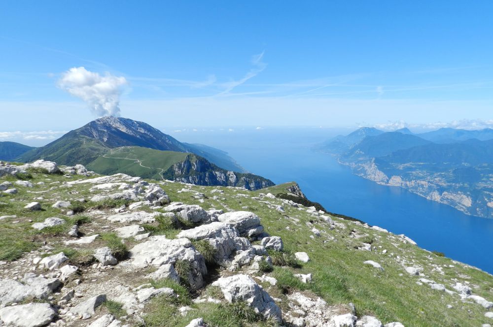
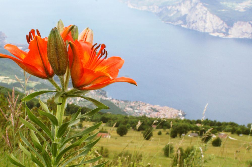
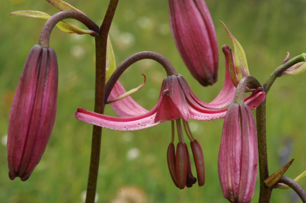
Monte Baldo, known as the botanical garden of Europe for its wide variety of alpine flora, which comprises also many species of orchids, attracts thousands of botanists and excursionists every year.
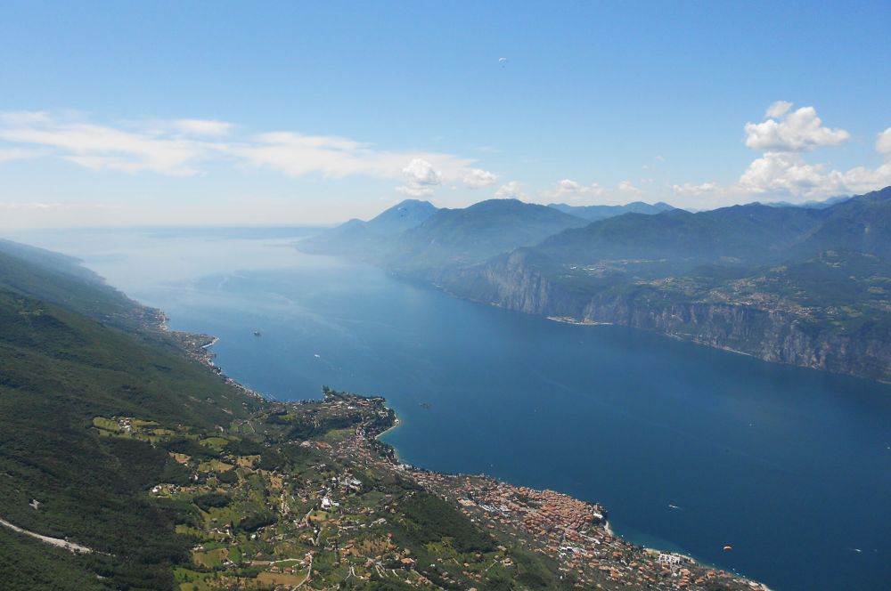
With its wonderful geographical position, Monte Baldo can benefit from an ideal climate in every season, for the joy of all sport lovers; here you can practise many sport disciplines such as, paragliding, nordic walking ( maps available here) excursions of different levels of difficulty, rock climbing, mountain bike and all winter sports including skiing, snowboarding, alpine skiing and mountaineering.
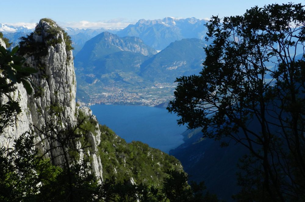
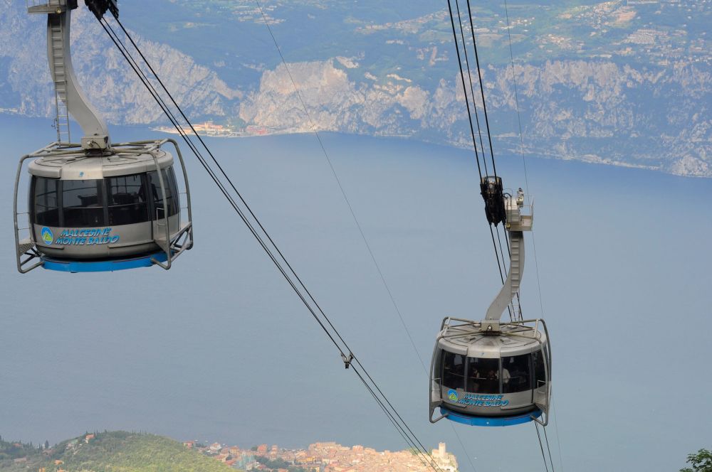
For those who want to spend a holiday on the lake surrounded by nature, Malcesine and the Holiday Apartments on Lake Garda are the ideal location: with the cable car you can easily reach 1760 metres of height, with a breathtaking view, an ideal experience also for trekking lovers. This area offers a wide variety of paths, from easy to difficult ones, leaving directly from Lake Garda and Casa Guarnati in Malcesine, to reach the highest tops at 2218 metres of height.
Mountain chalets are the ideal place to rest with a refreshing drink or to taste a typical local dish.
GPS Excursion Maps for Monte Baldo
- Glacial Amphitheater
- Cassone, Eremo, Fiabi, S. Maggiore, Malcesine
- Malcesine, Fubia, Bocca di Navene, Prai, Malcesine
- Tratto Spino, Ventrar, Tratto Spino
- Malcesine, Madonna dell’Accoglienza, Lavacco, Malcesine
- S. Michele, Piombi, Val Dritta, Tratto Spino, S. Michele
- Tratto Spino, Bocca Navene, Altissimo, Malga Campo, Monte Varagna, Prati di Nago
- Pellegrino Path – with the bycicle
GPS Excursion Maps for Monte Baldo
GLACIAL AMPHITHEATER
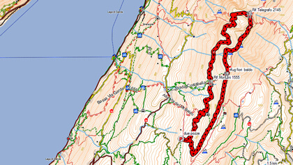
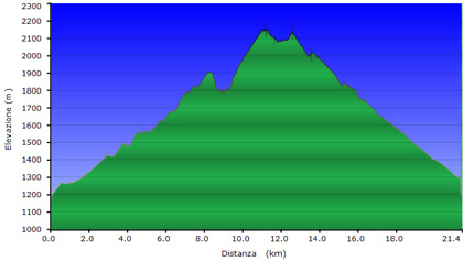
2 POZZE - Rif. MONDINI - Val di PRE - CIRCOLO GLACIALE - Rif. TELEGRAFO - Rif. FIORI DEL BALDO - 2 POZZE
Km 21,4
Time h 8,00
Kmh 2,7
Ascent 1405 mt
Descent 1405 mt
Path N°51-654-658-strada forestale
Along this track you pass through many different landscapes.
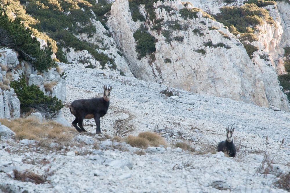
After the bar, the forest track goes through the mountain huts’ area up to the Mondini chalet, it follows the path and goes through the Buse Valley, the Pre Valley, to go up and then down again in the Glacial Circle valley, where you can admire the giant Pinus mugo (a typical mountain plant) and different species of animals. Back to the Telegrafo Chalet, a wide path crosses narrow valleys to open up again after Passo del Caminando through the Prati area, entering the wood in the last stretch.
Track Download
Km 15,4
Time h 6,10
Kmh 2.7
Ascent 820 mt
Descent 820 mt
Path N°31-1-659 (1)- 1
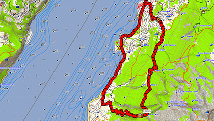
An itinerary of historic interest, that through steep mule tracks, paths and forest tracks passes through Casolari di Fichet and Capitello della Merla to reach one of the places where, according to history, lived in the IX century the hermits Benigno and Caro.
If you go on, you pass through Porta Vescovo and then down to Malcesine through Fiabi and S. Maggiore site.
Track Download
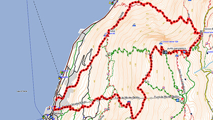
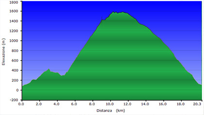
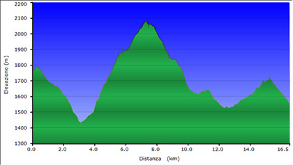
Km 20,3
Time 4,45
Kmh 4,3
Ascent 1729 mt
Descent 1717 mt
Path N° 4, 634, 651, 3, 2
Hard route that goes up into the valley, along the ascent overhanging Navene village, a steady ascent to be followed for over 2 hours to reach Bocca di Navene at 1425 metres of height, where you can find a resting place; from there you can go up again on the East side of the mountain to reach the path of Ventrar, that takes you back lo the lake side of Monte Baldo and down to Malcesine with a long descent.
Track Download
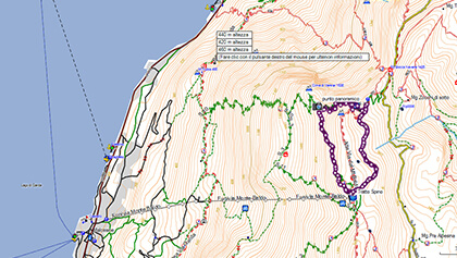
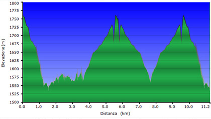
Km 15,4
Time h 6,10
Kmh 2.7
Ascent 820 mt
Descent 820 mt
Path N°31-1-659 (1)- 1
The route follows the top of Monte Baldo, with departure from and arrival at the upper cable car stop.
This is one of the most beautiful routes of the area.
It passes through deep valleys engraved into the rocks, in some stretches equipped with strings, and gets back rising along the Prati ridge.
In the flowering season, it is considered one of the most important locations of botanic interest.
Track Download
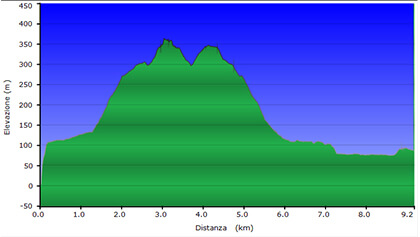
Km 6,4
Time h 3,10
Kmh 2,9
Ascent 329 mt
Descent 329 mt
Path N°--
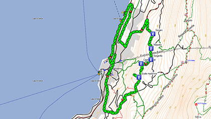
A route that enables you to discover the areas around Malcesine, among olive tree gardens, lake-view mule tracks and with a visit to Madonna dell’Accoglienza.
Track Download
Km 21,4
Time h 8,30
Kmh 2.7
Ascent 1800 mt
Descent 1800 mt
Path N°2-5-651-11-3-2
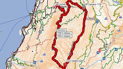
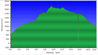
Very hard route that reaches the highest top of Monte Baldo (Val Dritta peak, 2218 metres) crossing the nature reserve of Lastoni Selva Pezzo in one of the loneliest and wildest environments of Monte Baldo.
For a stretch it goes up to Tratto Spino, passes through the high track of Monte Baldo to go down again to Mon De Bis, Coda Crac and get back to S. Michele.
Track Download
Km 16,5
Time h 6,20
Kmh 2.7
Ascent 800 mt
Descent 1000 mt circa
Path N°651-622-650-624B-601
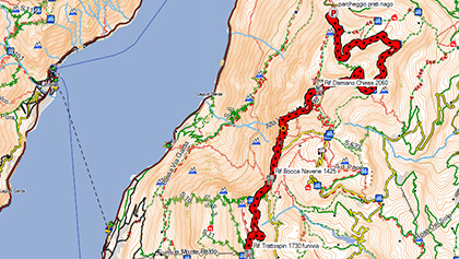
This route follows the last stretch of the high track of North Monte Baldo.
From Tratto Spino it goes down to Bocca Navene, runs on asphalt for a stretch, to go up again over the ridge, passing through the Damiano Chiesa chalet, from where in 5 minutes you can reach the top of Mount Altissimo.
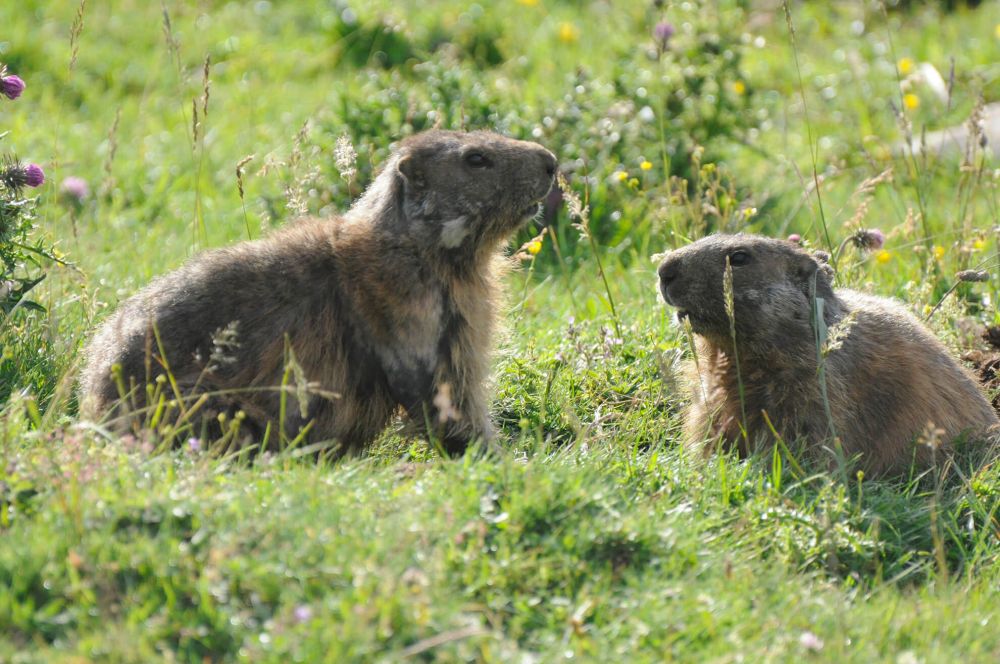
Then, following the last stretch on the ridge you go down to Malga Campo and cross the last open valley to the North, to go into the De Parol valley (an area populated by groundhogs) and rise again on Mount Varagna, where a forest road gets you down again to the parking of Prati di Nago.
There aren’t any public means or transport to get back.
Track Download
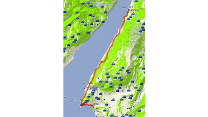
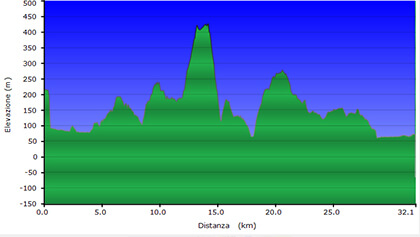
Km 32,1
Time h 2,00 circa
Kmh 16
Ascent 1059 mt
Descent 1080 mt
Path N° 31, 34
Ideal for the mountain bike, this amazing path along the lake, at about 200-450 metres of height from Malcesine to Garda runs almost completely along mule tracks and dirt roads, crossing the little villages of Campo, Pai di Sopra and Crero.
Track Download
Provided Services
![]() Environments Sanitized with OZONE
Environments Sanitized with OZONE
![]() Free Internet Wi-Fi
Free Internet Wi-Fi
![]() Heated swimming pool
Heated swimming pool
![]() Lawn chairs
Lawn chairs
![]() Children’s playground
Children’s playground
![]() Covered parking
Covered parking
![]() Covered storage for bicycles, motorcycles and sports equipment
Covered storage for bicycles, motorcycles and sports equipment
![]() Gym
Gym
![]() Satellite TV
Satellite TV
![]() Dishes & Utensils
Dishes & Utensils
![]() Laundry
Laundry
![]() Barbecue
Barbecue
Car and Scooter Rental in Malcesine
Directly in front of Casa Guarnati Holiday Apartments you will find a Car and Scooter rental to live your holiday on Lake Garda at best!
Rent Now a Car or Scooter in Malcesine


